Systems for
complex operations.

I design and build software that turns live data, infrastructure, and uncertainty into clear operational decisions.

Explore selected work
37.7749° N / 122.4194° W
LIVE SYSTEMATLAS / TERRAIN SURVEY

Selected work / 04 systems

01

Operational intelligence platform

ECHELON
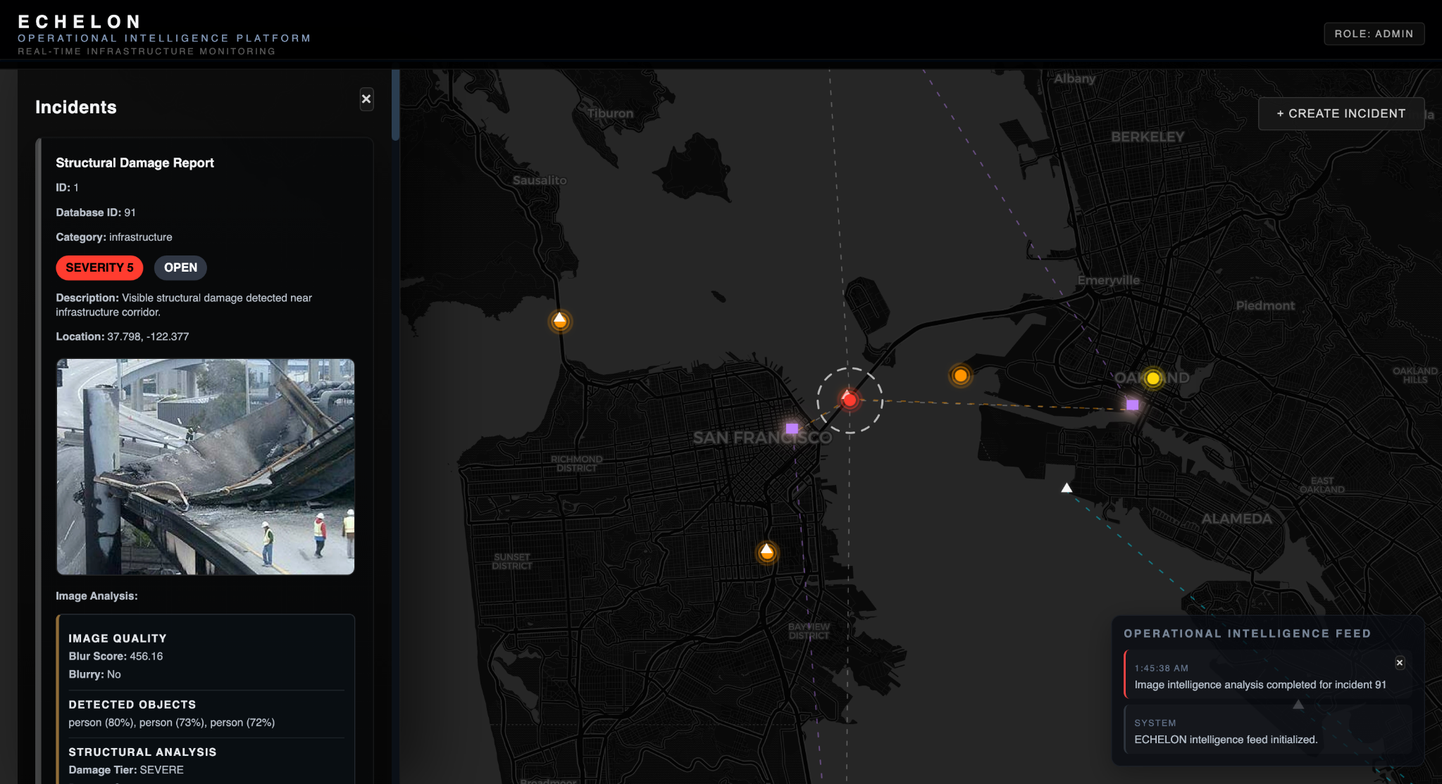
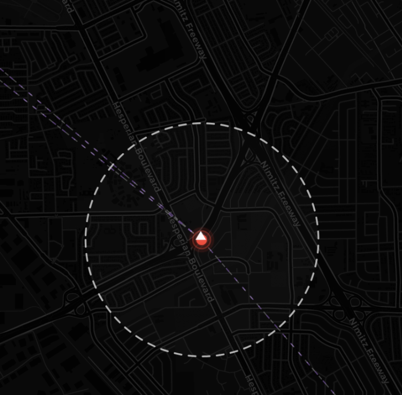
ECHELON operational intelligence dashboard showing infrastructure incidents on a Bay Area map
PROJECT / 01STATUS / COMPLETE

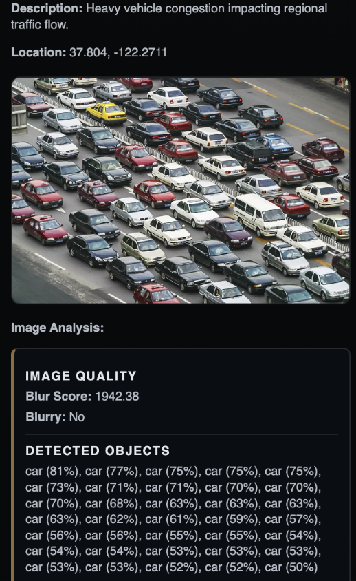
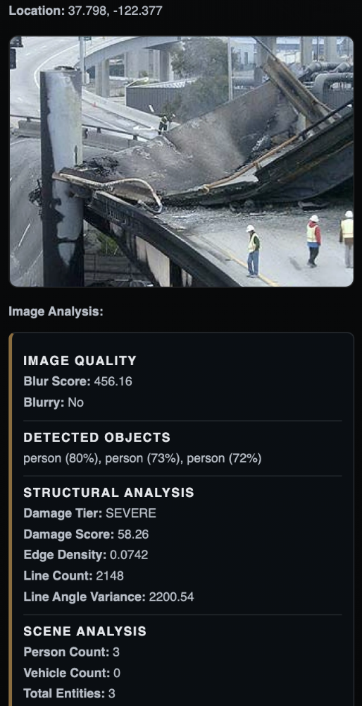
ECHELON analyzes images from active incidents with computer vision, running object detection and scene-level analysis across structural damage, hazards, crowds, and traffic. It then calculates risk to nearby infrastructure assets, traces the impact across dependent and cascading assets, and fuses the evidence into a final conclusion with recommended actions.

Engineering signalsCore / Supporting
  • PostgreSQL / SQLAlchemy
  • Docker / Pytest
View repository
ECHELON computer vision analysis of bridge damage showing detected people and severe structural damage metrics
02

Aerial terrain perception and routing

ATLAS

PROJECT / 02STATUS / COMPLETE

ATLAS converts aerial imagery into semantic terrain maps and rover routes. Mask2Former runs locally with PyTorch to classify roads, open ground, and obstacles. The application builds a weighted traversability grid, plans routes with A*, and reruns perception on selected route corridors before replanning.

Engineering signalsCore / Supporting
  • FastAPI / WebSockets
  • JavaScript / Canvas
View repository
03

Multi-robot warehouse simulation

FLEET CONTROL

PROJECT / 03STATUS / COMPLETE

A real-time warehouse fleet simulator coordinating multiple robots through shared space. A* routing, cell and edge reservations, yielding, and replanning prevent collisions; a traffic- and energy-aware scheduler improves throughput while battery management, failure recovery, persistence, and live event streaming keep operations resilient and observable.

Engineering signalsCore / Supporting
  • SQLite / State Recovery
  • Docker + AWS EC2 / CI
View repository
04

Food logistics command center

THE GRID

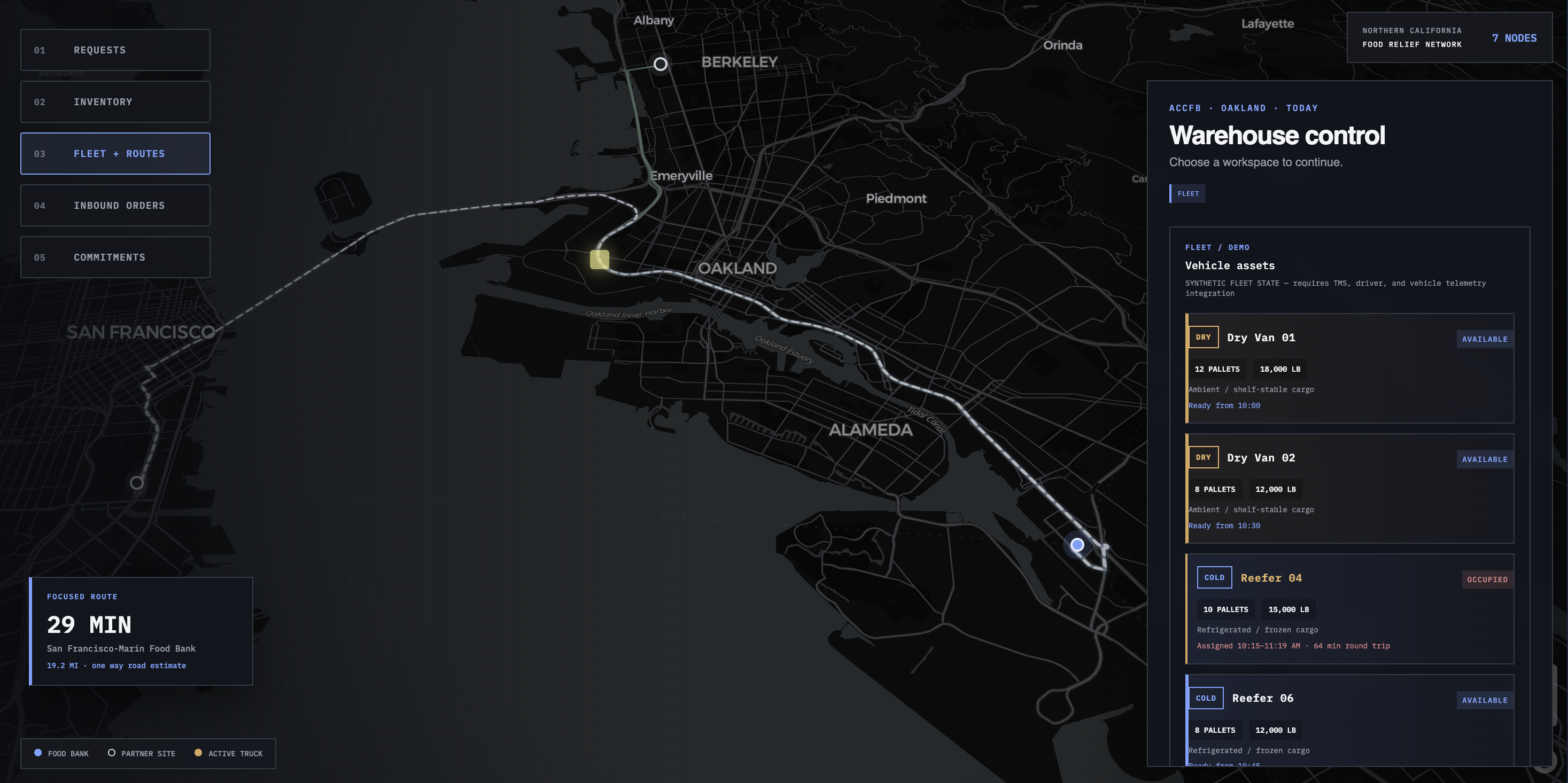
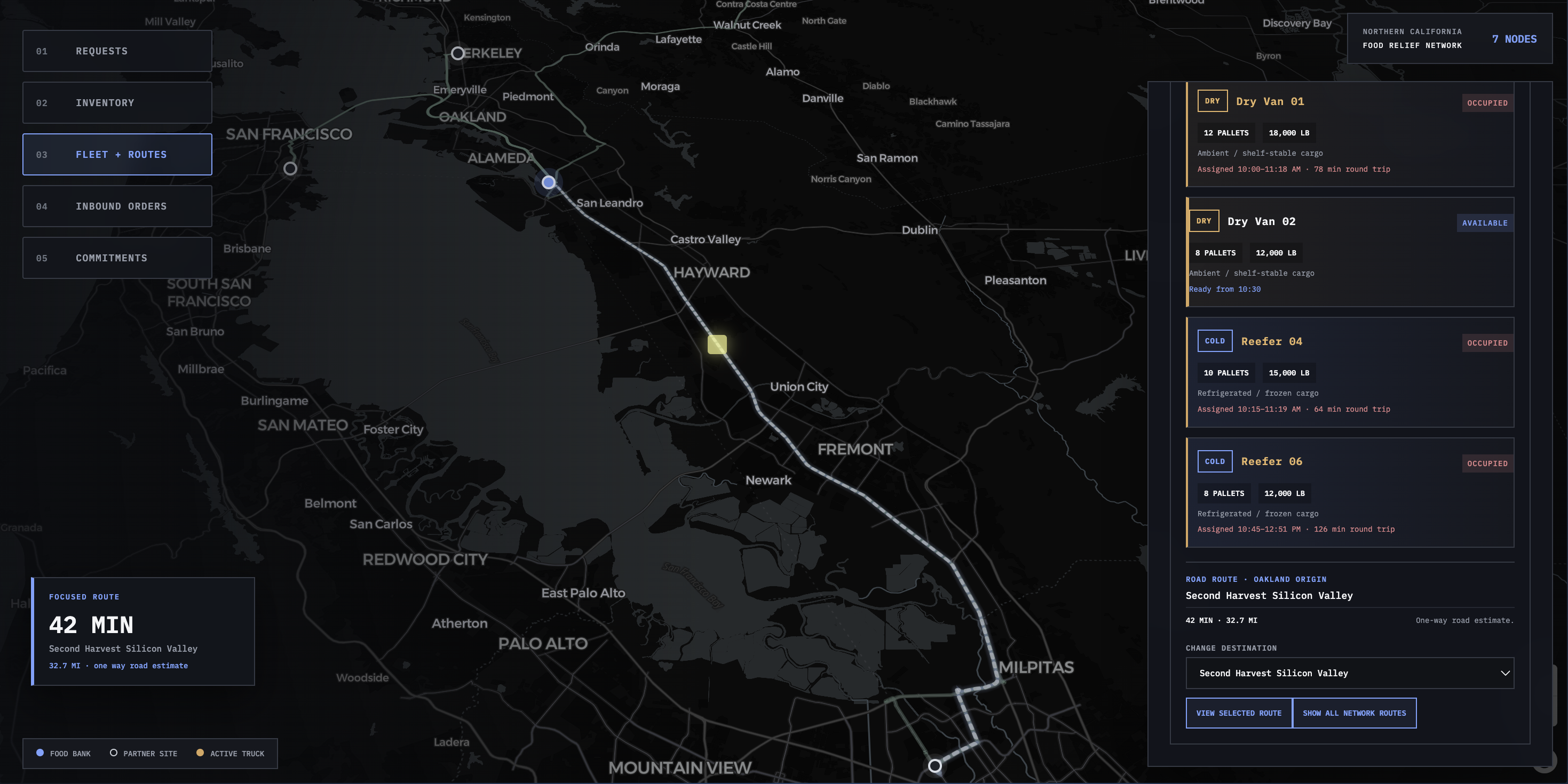
THE GRID fleet routing interface over a dark Bay Area map
PROJECT / 04STATUS / COMPLETE

A warehouse logistics prototype that turns requests, inventory, fleet capacity, and live routing into clear delivery commitments for food-bank operators.

Engineering signalsCore / Supporting
  • REST APIs / Async HTTP
  • Pytest / Systems Validation
View repository
THE GRID logistics network route view
Profile / Mark Amirkhan

Location / San Francisco, California

Mark Amirkhan in New York
Primary profile / MarkFrame 01

Mark Amirkhan / Engineer / Builder

I build serious systems.For work that matters.

I'm a full-stack engineer building software at the intersection of live data, computer vision, and geospatial intelligence. I take ambitious products from architecture to deployment—turning complex inputs into clear, dependable systems with real-world impact.

Backend & Full-Stack ArchitectureComputer Vision & Applied AIReal-Time Data SystemsGeospatial Platforms
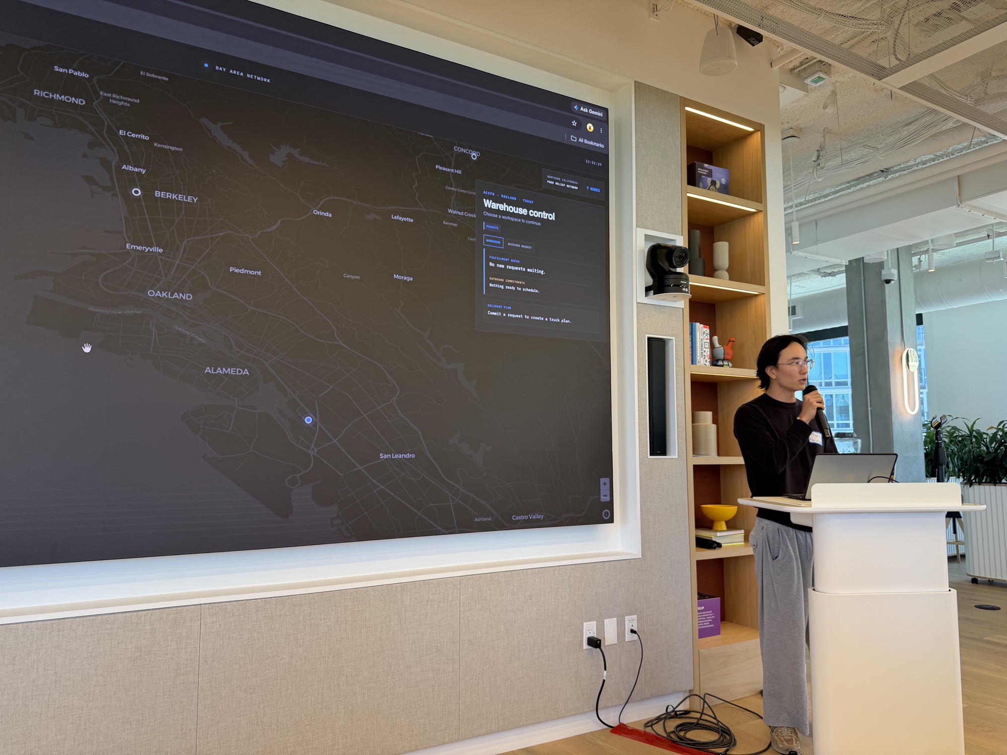
Mark presenting an operational geospatial system
System presentation / THE GRIDLinkedIn / Mark Amirkhan